Remote Sensing of Wildfire: Fuels, Fire and Recovery in a Changing World
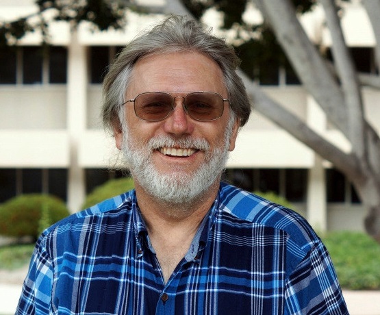
Dr Dar Roberts is a Professor in Geography at the University of California, Santa Barbara where he has served since 1994. He is the UCSB Principal Investigator of the Southern California Wildfire Hazard Center and leads the group in developing wildfire fuels maps and mapping fuel moisture using remote sensing.
Speakers
Event series
Content navigation
Description
Please note: this seminar is scheduled at 11am.
Please join the webinar via this link https://anu.zoom.us/j/268328831
Dr Dar Roberts is a Professor in Geography at the University of California, Santa Barbara where he has served since 1994. He is the UCSB Principal Investigator of the Southern California Wildfire Hazard Center and leads the group in developing wildfire fuels maps and mapping fuel moisture using remote sensing. He is best known for developing the concept of Multiple Endmember Spectral Mixture Analysis (MESMA), and pioneering work in hyperspectral remote sensing, including mapping plant species. Research interests include imaging spectrometry, remote sensing of vegetation, spectroscopy (urban and natural cover), land-use/land-cover change mapping, sensor fusion (including thermal), remote sensing of wildfire and trace gasses such as methane. He has worked extensively with passive optical sensors such as imaging spectrometry and active sensors, such as LiDAR. He is a Fellow of the American Geophysical Union and has authored of over 225 refereed publications and 15 books/book chapters.
Location
Webinar on-line seminar via Zoom.
Please join the webinar via this link https://anu.zoom.us/j/268328831
Upcoming events in this series

Pollinators are essential to plant reproduction, community structure, and ecosystem health, but those inhabiting alpine environments face strong thermal constraints.
Over the course of my PhD, I have had the pleasure of working in Australia's sub-alpine grasslands investigating the effects of heat and drought on plant functioning and carbon cycling.